
News and Events
Dec 08 2015Crop maps over Tula available
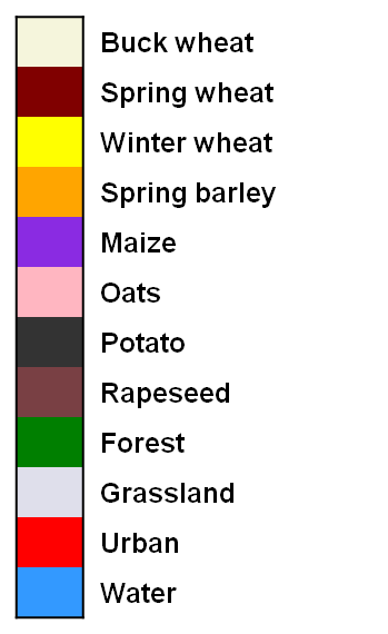
Three types of crop maps are provided:
- Pre-seasonal Cropland Layer (PCL) map estimated at the beginning of the growing season
- a Crop Group Layer (CGL) map discriminating winter crops derived at the end of the winter
- a high resolution Crop Type Layer (CTL) map updated at every acquisition along the season
These maps are generated using an innovative classification method combining medium and high resolution optical imagery with radar acquisitions. It has been developed to take advantage of the spatial coverage of Sentinel-3, the high spatial resolution of Sentinel-2 and the weather independent acquisitions of Sentinel-1. The demonstration over the Tula area for 2013 is done using proxies i.e. MODIS, RapidEye and Radarsat images, respectively.
Crop maps are provided in GEOTIFF files, associated with an ATBD and a PUM.
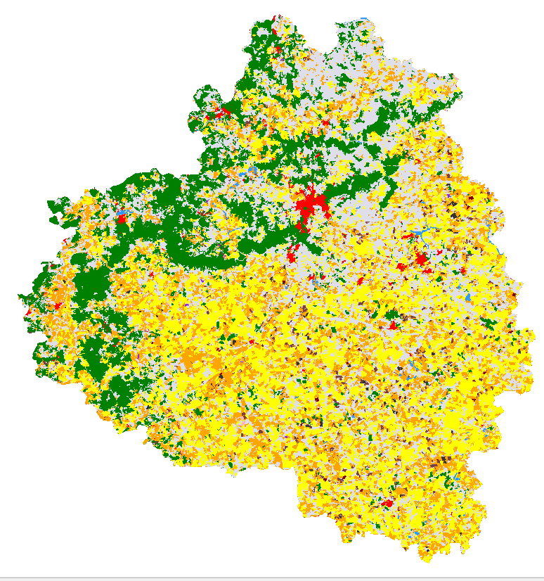

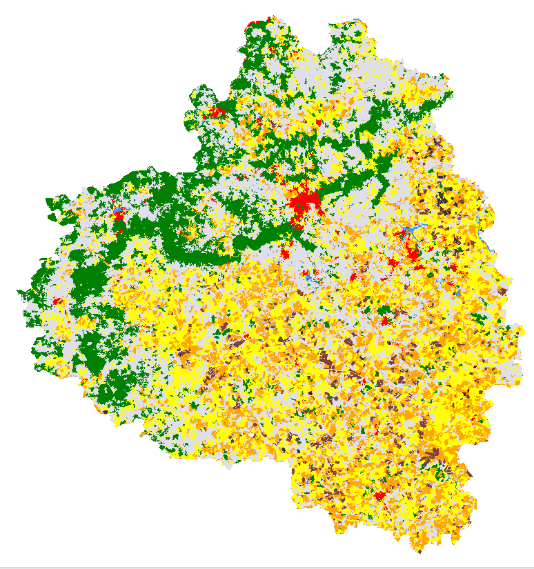

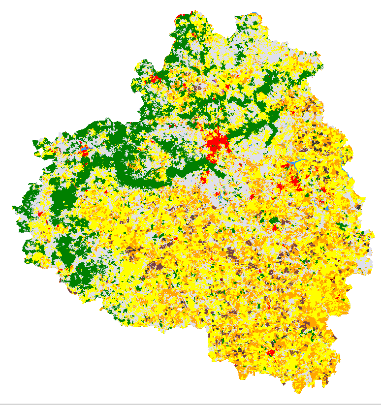
Crop type maps over Tula Oblast along year 2013: April, May, June, July and August, from left to right.
Back to Overview